As Hurricane Melissa made landfall on Jamaica as a Category 5 Hurricane around 1 p.m. on October 28, 2025, Team Rubicon Senior Associate for Mission Support, Francesca Williams, was at her desk in Texas, monitoring the disaster. Front and center was the Team Rubicon Geospatial Hub she had developed. Built on Esri’s ArcGIS Hub, it was replete with critical maps, data, and applications about current disasters and threats. It was designed to be a geospatial intelligence for humanitarian aid hub, one that would enable cadres of Team Rubicon volunteers, known as Greyshirts, to respond rapidly and effectively to hurricanes, floods, and wildfires—turning information into impact for affected communities.
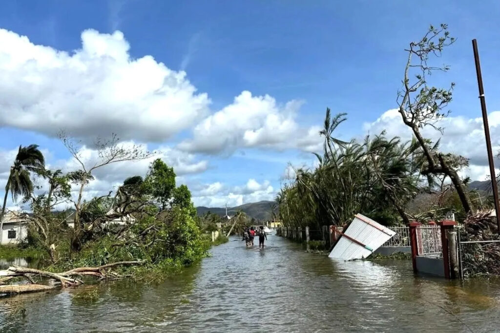
At the vanguard was the Hurricane Melissa COP—or common operating picture. Hurricane Melissa had made landfall near the town of New Hope, Jamaica, roughly 39 miles south of Montego Bay, packing maximum sustained winds of 185 mph. Then it churned north across the island for nearly four hours before emerging near Falmouth on the north shore as a Category 4 Hurricane around 5 p.m. And still, the damaging winds, catastrophic flash flooding, and life-threatening storm surge continued in Jamaica.
Williams monitored it all via her hub. There was the big picture, revealed in the Overview tab: a map that showed everything from Team Rubicon’s operations in planning to the status of various Caribbean airports to the locations of Jamaican hospitals. There were damage reports from the Government of Jamaica (GOJ) and the National Alliance for Public Safety GIS Foundation (NAPSG) that could be drilled down upon. Atop it lay the track of the storm.
On the next tab, the National Hurricane Center pages dedicated to Melissa kept refreshing to reveal updates about where the storm was. Williams could drill down and see updates about the storm’s progress without having to navigate away to another window. A YouTube live feed carried live multi-camera views from the island.
Meanwhile, an Incident Dashboard tab was capturing field reports of damage in real time. That data was coming from the government of Jamaica. Even as people on the island were sheltering in place, Williams and team could see the report numbers increasing. Click on one of the red dots, like the one mid-island, near Flat Bridge north of Spanish Town, that indicated a road was blocked by flooding, and a photo of devastating damage would appear.
Through it all, the western side of the island—between where Hurricane Melissa made landfall near New Hope and where it emerged roughly 33 miles northeast later—was eerily quiet. For those viewing Williams’ hub at that moment, it felt like a terrible harbinger of what Jamaicans were living through.
Geospatial Intelligence at the Intersection of Crowdsourcing and Social Media
Williams wasn’t the only one monitoring the TR GeoHub and the Melissa COP, and they weren’t just watching. Each tab held critical and crucial information that would help the operations team that Williams supports determine whether or not to stand up a disaster response operation in Jamaica, and teams across the organization were, at that very moment, doing just that. They were using the TR GeoHub to determine if, where, when, and how to send an advance disaster response team to the island.
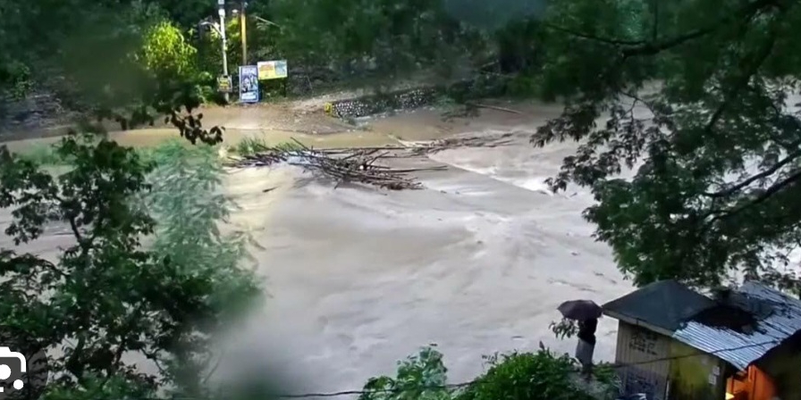
By day two, as Hurricane Melissa had exited Jamaica, was moving over eastern Cuba, and starting to emerge into the southwestern Atlantic, bringing its damaging winds, flooding rains, and dangerous storm surge to Cuba and the Bahamas, a new layer had appeared in the Hub. The Logistics Infrastructure Status tab—imported from the Logistics Information Exchange, or LogIE—was showing the physical condition of roads and rivers, including damage, flooding, landslides, and bridge statuses, as well as the status of essential ports of entry like airports and harbors. The tool integrates both existing data and intel crowdsourced directly from the field to create an operational picture for global and local humanitarian partners. For Team Rubicon, it was providing a better understanding of how and where it could deploy Greyshirts to the island to begin assessing the situation and preparing for a possible full-scale disaster response operation.
Then came a data explorer tab dedicated exclusively to Factal, the news organization that combines the ability to scrape social media with AI technology and a newsroom staffed by journalists. As it monitored different social media sources, Factal was providing, in very close to real-time, knowledge of what was going on and being talked about in Jamaica.
One Page to Rule Them All
It is common that, in the middle of an evolving and complex disaster, like Hurricane Melissa, there exists no one source of truth. The disaster is disparate. Infrastructure is often out. People remain sheltered in place. Governments and NGOs on the ground are also often digging out and cannot be everywhere at once in the minutes and hours after a disaster. For the leaders at Team Rubicon, the GeoHub was providing all of that. A landing page that collated multiple sources of information—official damage reports and crowdsourced information from survivors alike—in one single place, the Hub was allowing users to take deep dives into constantly updating intel.
In Chicago, Team Rubicon’s Deputy Director of Mission Support Traci Rankin and Deputy Director of Operations Justin Cronin were monitoring the TR GeoHub. The two were key players in a larger team working to deploy volunteers, or Greyshirts, to Jamaica as quickly as possible.

Rankin and Cronin were using the GeoHub for a perspective of island areas reporting the most damage and to anticipate where Team Rubicon might respond. More importantly, it was helping them understand—from afar—how Greyshirts might have to navigate the heavily damaged island.
“We’re assuming landslides block roadways and there’s damaged infrastructure,” said Rankin. “The reported information the Hub gives us helps us prepare the team prior to arrival, paints a better picture of what they can expect once they get there, and helps them identify how to get around a landslide, for example, in order to reach communities that need our immediate help.” Plus, the Greyshirts would also be able to access it once on the ground in Jamaica for constantly updating information.
Using Geospatial Intelligence for Humanitarian Aid Operations, and Serving Hurricane Survivors Faster Than Ever
When the first wave of Greyshirts departed for Jamaica on Thursday, October 30, they took a Starlink mini, satellite phones, a Garmin InReach, cell phones, Signal, and additional redundant comms with them. Williams and team had also created a separate web map for the volunteers to use in an ArcGIS Field Maps application which had built-in offline functionality. And, there was the TR GeoHub. Combined, they would allow the Greyshirts to navigate the island—including understanding how to get around roadblocks caused by Hurricane Melissa.
Back in the U.S., Williams was filled with anticipation about how the Hub might perform in Jamaica.
“I hope it proves useful in providing the team on the ground with information on which communities they should prioritize outreach in,” she said.
And, that they would be able to get to those communities faster and easier than they might otherwise have.